Amicalola Falls State Park, Dawsonville, GA
New Appalachian Approach Trail/
Base of the Falls Trail and Hike Inn Trail
|
LOCATION:
280 Amicalola Falls State Park Rd Dawsonville, GA 30534 PHONE: (706) 344-1500 Reserve: RATES: $25 - $49 CHECK IN/OUT: Check in at 1 pm/Check out at 11 pm. ACCESS: No gate MAPS: At Lodge SITES: 24 PULL THRUS: No WATERFRONT: No PICNIC SHELTERS: Yes SITE SURFACE: Gravel HOOK-UPS: Water & 30/50 Amp WIFI: Yes CABLE: No SEWER: No BATH: Yes LAUNDRY: Yes DUMP STATION: Yes SHADE TREES: Yes POOL: No BOAT RAMP: No FEATURES: Falls, Lodge with restaurant, and cabins RANKING: have not camped here. PET FRIENDLY: Yes NEARBY ATTRACTIONS Burts Pumpkin Farm Chattahoochee Nat'l Forest Dahlonega Gold Mining Kangaroo Conservation Ctr Blue Ridge Scenic Train |
I can't say enough about this Georgia State Park. It has the highest waterfall in Georgia and is magnificent. The name "Amicalola" is derived from a Cherokee word meaning "tumbling waters."
In 1957 the Appalachian Trail Club rerouted the start of the Appalachian Trail to Springer Mountain. The park began to serve as the access point for hikers. The hill leading to campground is very steep with a 25% grade. The park recommends coming prepared to use a low gear and travel at the park speed limit of 15 mph. Know your vehicle's towing capacity and state of repair before attempting the climb. We have never camped here so didn't give it a rating. In June 2012 we hiked starting at the Creek Trail and turning left onto the Mt Laurel loop. We were able to pick up the Springer Trail. This will take you across a parking lot to the West Ridge Falls access to the base of the falls. This trail is rocky with lots of roots and of course uphill all the way. It's all worth it to see the beautiful waterfall and feel the spray. Returning down we had 145 steps to reach the trail and then followed the Appalachian Approach Trail past the reflecting pond. There are several trails here ranging from easy to strenuous. The Base of the Falls Trail is 8.5 miles. The first mile is 604 staircase steps and takes you to the falls overlook. From there you would join the old Appalachian Approach Trail. This trail is strenuous due to the steep slope and stairs. The stairs are also very difficult for dogs. The East Ridge Trail is 1 mile and rated moderate to strenuous. This trail is not blazed and was previously used as the approach to the Appalachian Trail. It follows part of an old road bed from the Visitor Center to the top of the waterfall. The Creek Trail is 0.6 miles and rated moderate. It is blazed yellow. This scenic walk leads from the Visitor Center to the Reflection Pool at the base of the falls. The Spring Trail is 0.4 miles and rated moderated. It is blazed orange and connects the parking lot of the West Ridge/Falls Access GTrail to the Mountain Laurel Loop Trail. The Mountain Laurel Loop trail is 1 mile and rated moderate. This trail is blazed green and runs along the ridge above Amicalola Creek. Access is provided by the Spring Trail or Creek Trail. New Appalachian Approach Trail/Base of the Falls Trail is 15.5 miles and the park's most popular and scenic trail. It follows the creek and waterfall on a series of stairs and decks. This trail is moderate to strenuous due to the steep slope and stairs. This is challenging day hike, an even better overnight backpacking adventure, or the ultimate start to a thru-hike on the Appalachian Trail to Maine. The West Ridge Falls Access Trail is 0.3 miles and is rated easy to moderate. This trail is wheelchair accessible with a gentle slope. One of the best views of the falls is found on this easy trail. The trail is made of recycled-tires. The Lodge Fitness Loop is 0.25 miles and rated easy. This paved trail is wheelchair accessible and lighted for early morning and/or evening use. The Hike Inn Trail is 5.5 miles and rated moderate. This trail is blazed yellow and is the only access to the Len Foote Hike Inn and a permit must be obtained from the visitor center to hike this trail. The Amicalola Falls Loop Trail is 2.1 miles and begins under a stone arch commemorating the Appalachian Trail. The trail climbs to a ridge with incredible views, and then winds down a series of stairs flanking the tumbling waterfall. DIRECTIONS:
From Jct Hwy 53 & Hwy 9: Go 10 mi NE Hwy 9, then 15 mi W on Hwy 52 (R) Half-way between Elijay & Dahlonega. Parking fee required. CAUTION: 25 degree grade to campsites, not recommended for RVs over 30'. 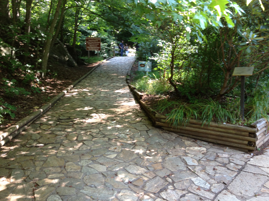 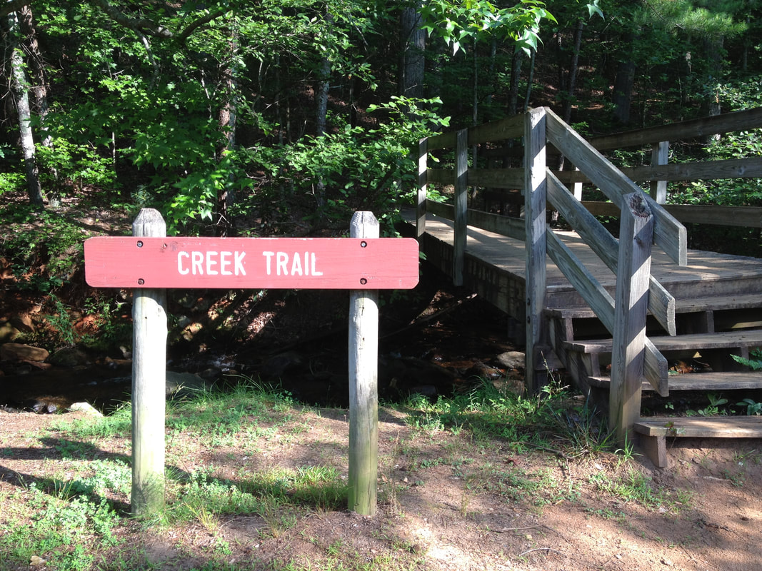 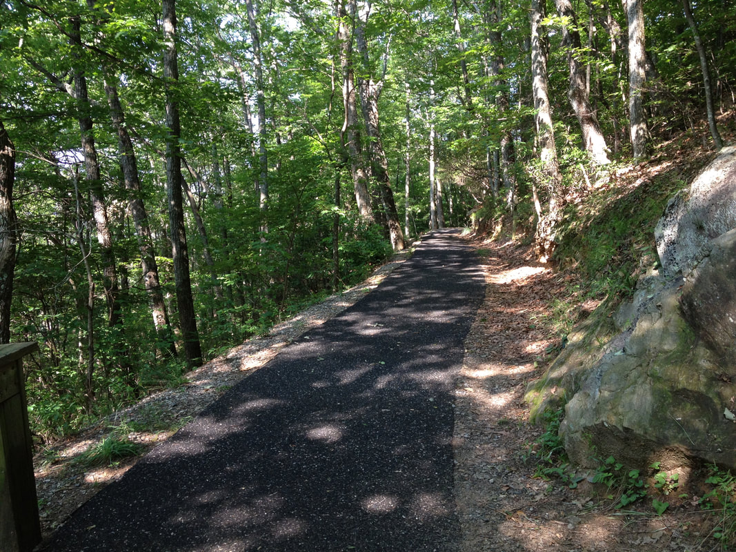 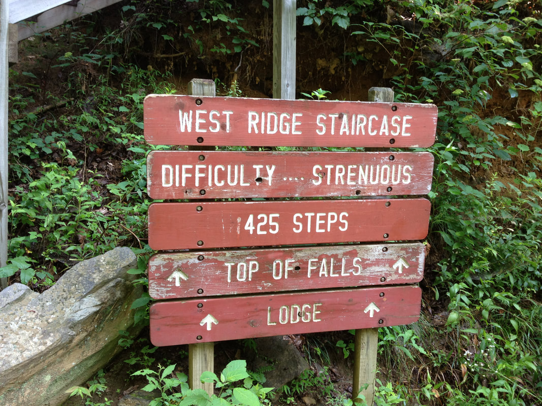 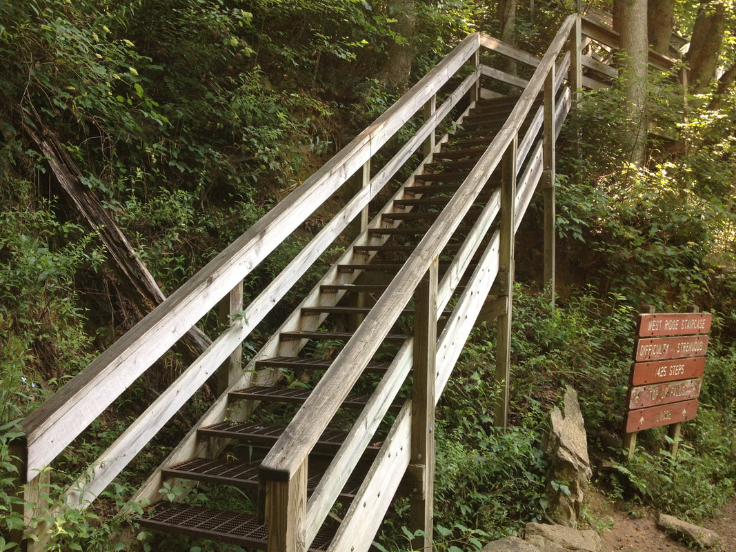  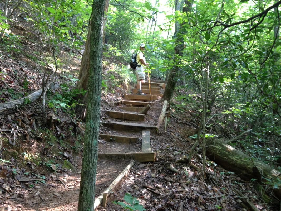 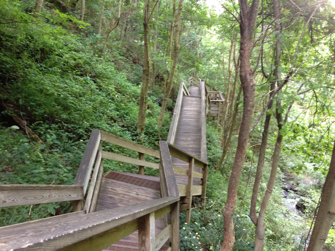 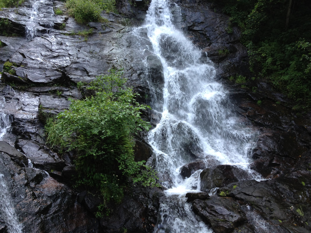  |
HTML Comment Box is loading comments...
