James H. "Sloppy" Floyd State Park, Summerville GA
|
LOCATION:
2800 “Sloppy” Floyd Lake Rd Summerville, GA 30747 PHONE: 706-857-0826 Reserve: 800-864-7275 Site Specific RATES: $32 - $35 CHECK IN/OUT: 1:00 pm. ACCESS: 7 am - 10 pm MAPS: At Ranger Station SITES: 25 PULL THRUS: Yes WATERFRONT: No PICNIC SHELTERS: Yes SITE SURFACE: Gravel HOOK-UPS: Water & 30/50 Amp WIFI: No CABLE: No & no antennae SEWER: No BATH: Yes LAUNDRY: Yes DUMP STATION: Yes SHADE TREES: Yes POOL: No BOAT RAMP: Yes FEATURES: two lakes, fishing, 5 miles of park trails, kayak/canoe rental, playground. Pinhoti Trail runs through the park RANKING: 8.5 PET FRIENDLY: Yes NEARBY ATTRACTIONS Cloudland Canyon State Park |
James H. "Sloppy" Floyd State Park is 561 acres and located near Summerville, Georgia. The park was first operated as a public fishing area under Wildlife Resources and called Chattooga Lakes Public Fishing Area. In 1973 it became a state park and named Chattooga Lakes State Park. In 1974 the park was renamed James H. “Sloppy" Floyd State Park. James H. “Sloppy" Floyd was a state representative serving in the Georgia House of Representatives from 1953 until his death in 1974.
This is a very quiet park surrounded by the Chattahoochee National Forest with two stocked lakes for fishing. There are no motorboats allowed on the lakes but kayaks, rowboats and electric powered crafts are permitted. There is a 3-mile loop trail called Lake Rim Trail that covers both lakes and the Pinhoti multi-use trail developed by the forest Service and local volunteers. The highlight of the park is the Marble Mine Trail leading hikers to the entrance of an old marble mine that was developed before the park existed. We camped here in September 2019 and loved hiking to the Marble Mine and riding our bikes throughout the park. Our cats loved walking on the trails and being lazy at the campsite. DIRECTIONS FROM ATLANTA:
Take I-75 N to Exit 306 (GA 140). Turn west (toward Adairsville) and travel 16.0 miles to U.S. 27, the Martha Berry Highway. Turn right and follow US 27 for 11.2 miles. At Sloppy Floyd Lake Road turn left and travel 2.8 miles GPS Info. (Latitude, Longitude): 34.43972, -85.33917 34°26'23"N, 85°20'21"W  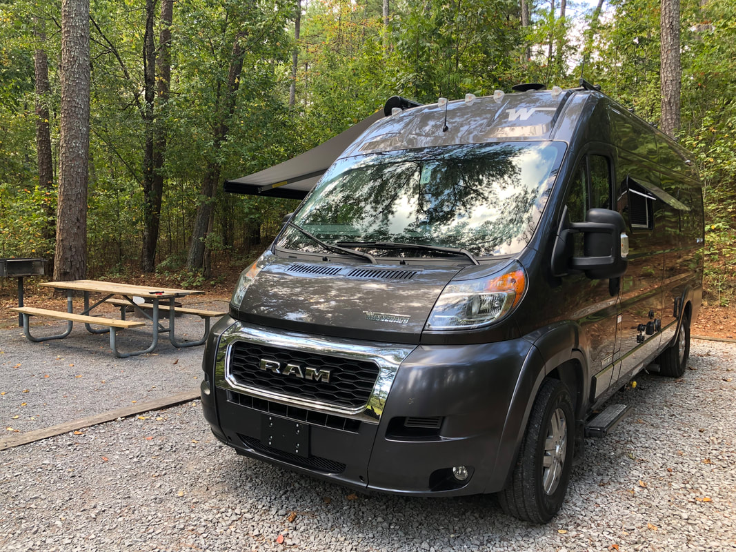 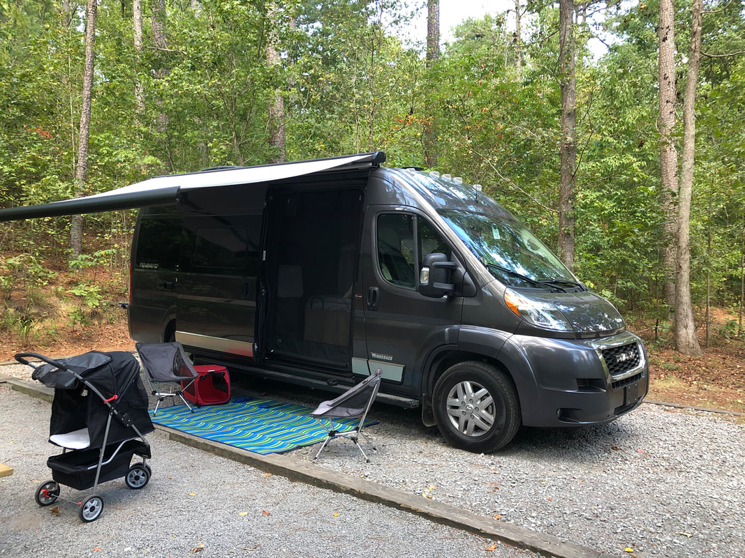   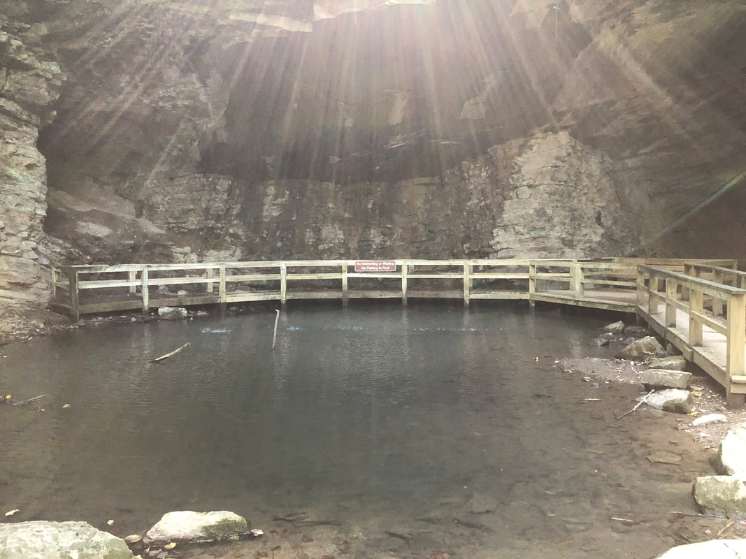 |
HTML Comment Box is loading comments...
